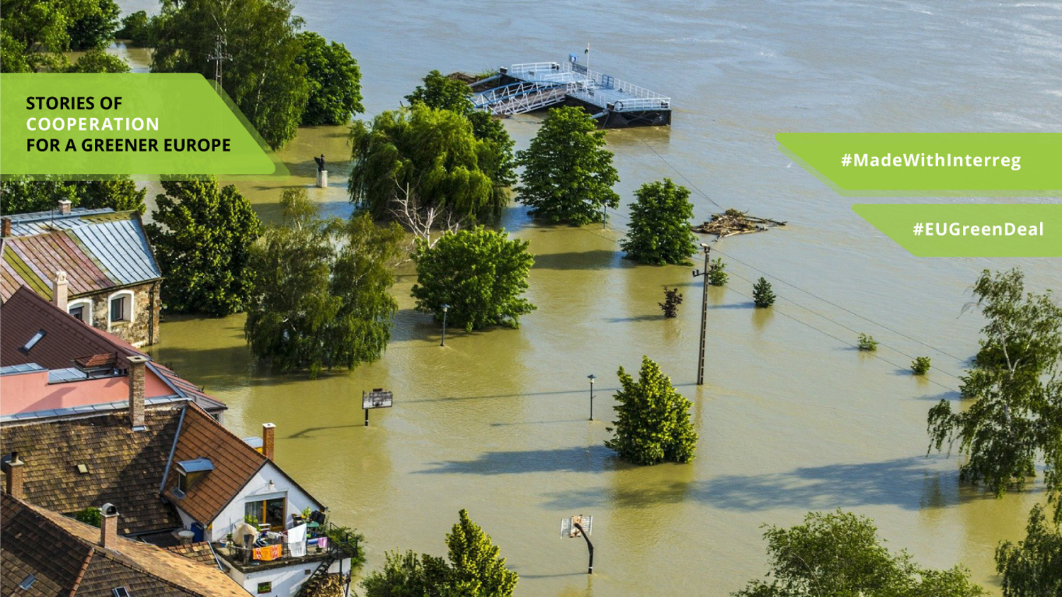
Cross-border cooperation when floods cross borders
In August 2017 it happened the worst flooding to affect Northern Ireland in almost 30 years. 63% of the average August rainfall fell in the affected areas within an 8 or 9 hour period, destroying bridges, roads and hundreds of people rescued from their homes. In December 2015, 5,200 homes were affected by flooding in the United Kingdom, with an estimated flood damage cost of £5 to £5.8 billion in the Northern Ireland and the north of the United Kingdom.
One of the main reasons for these devastating events is climate change. The occurrence of various natural phenomena, such as storms or cyclones, is causing major coastal flood in several urban and rural areas with extremely violent effects in all countries of the European Atlantic region. In the Danube basin, climate change is expected to further increase flood risk too, especially in the former floodplains, which have been drained and cut off from their rivers to allow for human settlement and agriculture.

Another main challenge for flood management is the lack of local planning management, the difficulties in cooperation among different public bodies on planning and managing an emergency and the accuracy of the flood modelling used. At EU level flood management is carried out both on a regional scale or, following the European Directive 2007/60/EC, at a river basin scale. The challenge is the application of tools and capabilities to the local scale.
Adaptation of flood management plans to climate change
To overcome the challenges to cross-border flood management, Interreg projects are proposing a joint approach. Interreg Atlantic Area AAFLOODS project is developing models for local action plans on flood risk management and on new methodologies for flood modelling and early warning. The consortium is working to improve tools of prevention, warning and emergency management for floods at local scale.
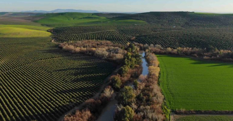
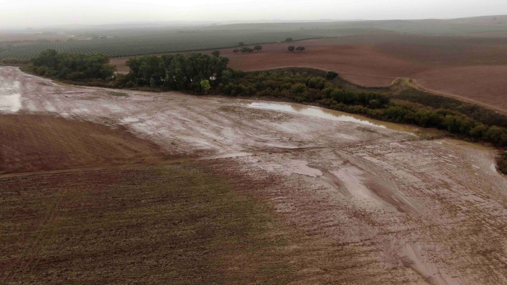
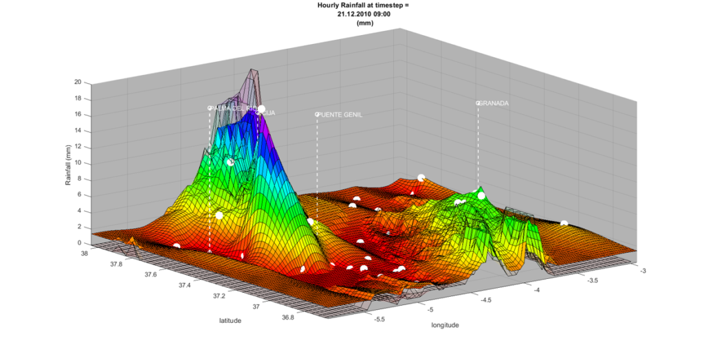
Three pilots are being developed in Spain and Portugal. Two of these pilots are in Andalusia, Spain. One is based in 5 towns with different sizes and urban types of settlements united by the fact that they suffer periodical floods due to torrential rains. The other one is along the most dangerous stretches of the Genil River.


The use of 3D cartography obtained with LIDAR technology in water flows modelling, helps to improve the design of the sanitation networks to evacuate rainwater more effectively and to simulate the river behavior in periods of torrential rains.
A third pilot is being implemented in inland territory affected by the estuary of the Arade River, in Algarve, using the same technology to improve the management of the reservoirs, especially their discharges of water when torrential rains fill them to their maximum capacity.

The results of these pilots are applied to the Local Flood Risk Management Plans, because flood events happen in very specific points, where maximum coordination and clear protocols are needed in the shortest possible time to prevent, manage and recover from a flood.
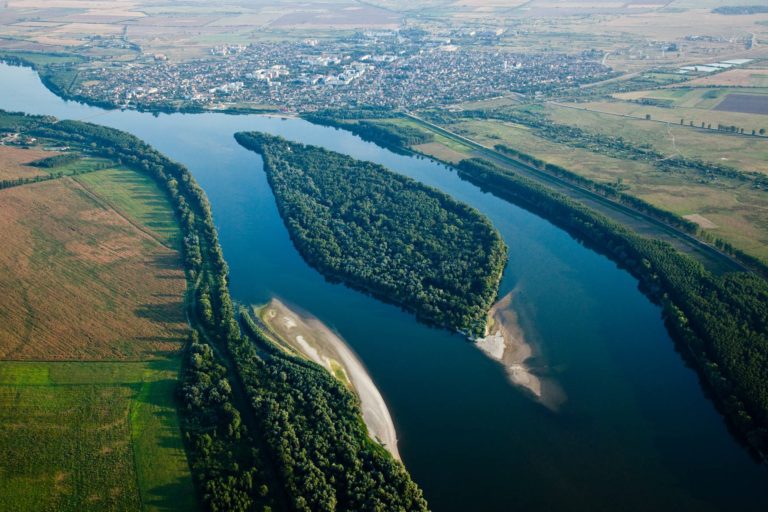
Based on a nature-based approach to flooding, Interreg Danube project DANUBE FLOODPLAIN provides another solution, reducing the risk of floods in urban areas by reconnecting the river to its floodplains. It developed tools for ministries, river basin authorities and other stakeholders in Danube river basin for floodplain restoration.
One of the five pilot locations where floodplain restoration measures were investigated is also the Bistret-Nedeia-Jiu area in Dolj County. 'The Bistret area was chosen precisely in the light of the flood events that took place in 2006 and we try to find the best solutions to consolidate the existing works,' says Sorin Rindasu. According to him, the results of the studies done on pilot locations will, on the one hand, help the realization process in the pilot areas, on the other hand, they will deliver experience and recommendations for similar restoration projects in other floodplains along Danube and its tributaries.
Using a Geographic Information System (GIS) tool called (Danube Floodplain GIS, the project identified areas that are best suited for this purpose. These were areas with natural capacity to retain floodwaters, and at the same time, having potential to improve biodiversity and to provide benefits to local economies, for example through fisheries and recreation.

Always better together
Transnational cooperation has provided a contribution of new ideas that partners are applying in their territories based on the experiences of their peers. Even regions disparate in their geography or institutional architecture find the experience sharing among partners applicable: for example, the river basin management approach carried out in Spain since the 19th century (it was the 1st European country to do so) is now being promoted also in the UK, and the design of nature-based solutions in which the British are very advanced, is particularly interesting for the Spanish.